2020 Geography Award Winners
Congratulations to all of our 2020 Geography Department award winners!
- Award for Service to the Geography Department: Sophie Laboissonniere
- Carto Cup 2020: Chloe Sandahl
- CAG Undergraduate Award: Alex Harte
- Lady Rose Award: TBA
- Don Stone Scholarship: TBA
New Summer 2020 Course!
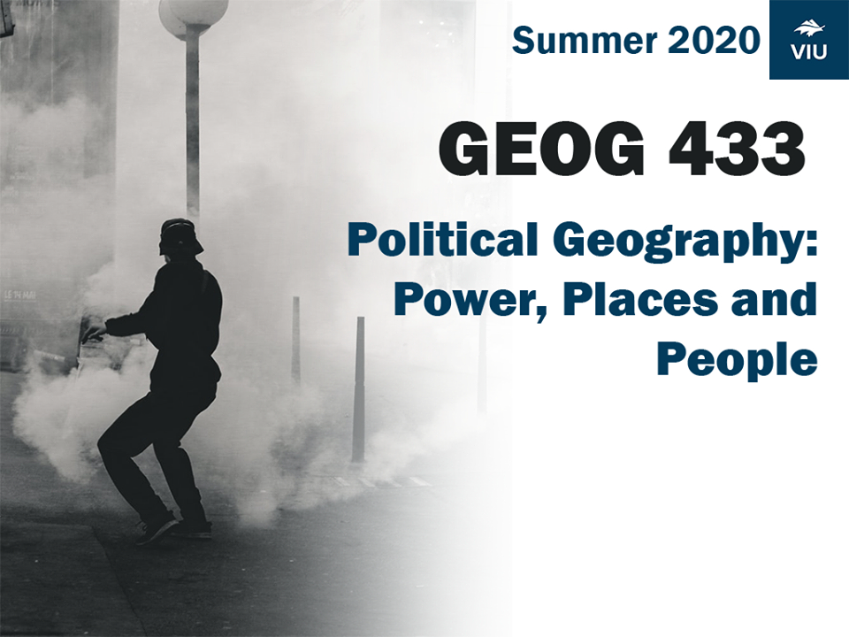
Political Geography: Power, Places and People

If anyone is still looking for a summer course, Geog 433: Special Topics in Geography has a few seats left. This summer offering is "Political Geography: Power, Places and People". It is open to anyone at VIU with 3rd year standing.
"Do you want to understand how power and place are related? Do you want understand how power and place shape identity and influence people, all while earning 4th year credit towards your degree? GEOG 433 this summer is the right course for you!"
14TH ANNUAL URBAN ISSUES FILM FESTIVAL – “THE BEST EVER…”
November 8th saw the launch of the 14th Annual Urban Issues Film Festival on the theme of “Urbanization Around the World.” At its peak, approximately 100 people were in attendance. In addition to a variety of dynamic short films, the organizers also experimented with Menti, an interactive program that audience members used to voice their opinions on their phones in relation to the films and related topics. Two members of the organizing committee also premiered a short film in which international students weighed in on the differences between Nanaimo and their home communities.
The whole event was MCed by VIU grad, Caelen Middleton, who brought boisterous good spirits to the event. In addition to sponsorship and donations by the Geographic Students’ Union, the Master of Community Planning (MCP) Students’ Association, Geography, MCP, and the Sustainability Advisory Committee, the Planning Institute of BC (North Island chapter) co-sponsored and paid for the free pizza dinner for everyone in attendance. A hallmark of this year’s festival was that it was exclusively student-led. Some of the students who were actively involved in organizing this year’s event will still be around for next year’s 15th year – Ruby – Festival which we are anticipating will be a smashing success!

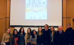
The Crew of volunteers for the Film Festival
2019 Winners of our Geography Department Awards
Congratulations to all of our 2019 Geography Department award winners!
Queen Elisabeth II Diamond Jubilee Scholarship: Jeff Fontaine, Alex Hart
Award for Service to the Geography Department: Caleb McIntyre
Carto Cup 2019: Andrew Wilson
CAG Undergraduate Award: Steve Hextall
Lady Rose Award: Steve Hextall
Don Stone Scholarship: Graham Louwers
Congratulations Pam Shaw!
Please join us in congratulating Geography Department faculty member Dr Pamela Shaw, RPP, FCIP, on her induction into the Canadian Institute of Planners College of Fellows!
"Fellowship is a special status for Members developed by the Canadian Institute of Planners that recognizes excellence, identifies prominent role models, promotes advances in planning practice and draws leaders to the forefront of planning in Canada. Election as a Fellow of the Canadian Institute of Planners is the highest award the Institute can give to a planner. It is given only to those Members who exhibit the highest professional attainment and exhibit a wide breadth of experience. Such professional attainment and experience must be significant within a Canadian or international planning context." CIP College of Fellows.

Pam Shaw
New Geography Department Internship Opportunity – Register now for Spring 2020
Beginning this academic year (2019/2020), Geography will be offering an optional Internship opportunity for Geography Major and Minor students in their 3rd or 4th year. Internship programs are a way for students to gain work experience in their field of study, through career development and placement. At VIU, Co-ops and Internships are managed by VIU’s Centre for Experiential Learning (CEL) and used by a variety of VIU programs, from Criminology, to Physical Education to Interior Design, among others. For more information about CEL, please visit: https://services.viu.ca/centre-experiential-learning
To participate in this Geography Internship opportunity, you first need to register for a geography specific three-credit course taught by CEL faculty in the Spring 2020 term. Please confer with VIU Advising to confirm that the credits for the INTP 300 course and summer internship credits meet the requirements for your future graduation needs. This course is:
-----------------------------------------
Planning for Upper-Level Internship: INTP300 - Section S20N72. Provides opportunities for students to synthesize theoretical knowledge and practical experience within their field of study. By engaging in a variety of self-discovery activities students will identify skills, strengths, interests, values and competencies to inform their search for a relevant and meaningful internship experience.
--------------------------------------
Upon completion of INTP300, you will then be eligible to take part in a work experience internship in the summer. These work experience placements, which may involve government, the private sector, the not-for profit sector or others, will be identified through an effort involving the CEL, the Geography department faculty and the student.
The INTP300 Section S20N72 course can be found through the VIU student timetable (https://isapp.viu.ca/srs/timetable.htm):
- Term: Spring 2020
- Campus: Nanaimo
- Program Area: All program areas
- Course ID: INTP 300
For more information contact: Michele Patterson (Geography Chair)
geochair@viu.ca or
michele.patterson@viu.caCongratulations Jeff Lewis!
Join us in congratulating faculty member Dr Jeff Lewis, recipient of a 2019 Provost's Award for Excellence in Teaching Design and Practice that Enhances Deep Learning! Jeff will receive his award at June 2019 convocation ceremonies.

Jeff Lewis in action
VIU Researchers Aim to Develop Improved Mapping Methods For Canada's North

Professors Brad Maguire (Left) and Jerome Lesemann (Right)
Below are excerpts from the full VIU News article (released January 15, 2019 - 10:30am) which can be found here.
A Vancouver Island University (VIU) research project will provide a unique opportunity to examine the glacial landscape of Canada’s North, leading to new mapping methods that will help people identify sources of sand, gravel or minerals.
VIU Professors Dr Jerome Lesemann (Earth Science Department) and Dr Brad Maguire (Geography Department), with the help of Yiqing Luo, a VIU Master of Geographic Information Systems (GIS) Applications student, are being funded by Natural Resources Canada (NRCAN - Earth Sciences Sector) to assist in the development of better remote predictive mapping (RPM) methods aiding exploration.
Mapping of surficial materials is an integral component of development in northern Canada. “Traditional methods of surficial mapping, employing aerial photographs and field verification, are both time-consuming and expensive,” says Maguire.
Lesemann and Maguire’s research project aims to develop a methodology for computerized detection of the sediment components of eskers, ridges of gravel and sand which occur in formerly glaciated regions of northern Canada.
“Eskers are ubiquitous glacial landforms, formed in ice tunnels made by water flowing under the ice sheets. The long-winding ridges of stratified sand and gravel are some of the most abundant and accessible sources of aggregates for infrastructure growth needed for road building in northern regions,” says Lesemann. “And they are prime sampling targets for commodities like diamonds.”
Using newly available digital terrain models, landforms like eskers can now be identified and mapped in great detail. The team is developing a methodology to automatically detect and map these landforms. The VIU project team proposes to develop an esker element detection methodology based on Deep Machine Learning (a form of Artificial Intelligence) supported by a Convoluted Neural Network (CNN). CNN uses computer algorithms to try and replicate complex cognitive processes of the human brain.
“This is a significant Canadian undertaking with many partners, and it’s exciting for us to contribute to our understanding of past ice sheets and to the development of improved mapping methods,” says Lesemann
MEDIA CONTACT:
Annette Lucas, Communications Officer, Vancouver Island University
O: 250.741.2020 | C: 250.618.7296 | E: Annette.Lucas@viu.ca
The 13th Annual Urban Issues Film Festival A Great Success!
The 13th Annual Urban Issues Film Festival, on the theme of “Resilience in the Face of Climate Change,” was possibly our most successful to date. There were about 110 people at the beginning, a very festive pizza dinner a couple of hours later, and an inspiring keynote by activist, author, and futurist Guy Dauncey. Both Guy’s talk and the films were well-received, and discussion was spirited. The volunteers from Geography, Community Planning, and other faculties and departments made a great team, meeting weekly during the months leading up to the event to design and plan its every aspect.
Sponsors included the Geography Department, the Geographic Students’ Union, the Planning Institute of BC (North Island chapter), and Master of Community Planning (MCP) Students’ Association. Geography, the GSU, and MCP all contributed financially, as did the Faculty of Social Sciences and VIU’s Sustainability Advisory Committee (SAC).
A subsequent showing, during WorldVIU Days, of “Metamorphosis” by Nova Ami and Velcrow Ripper, also attracted a healthy crowd of 60 to 70, and featured a workshop on the film’s themes the next night. The film showing was sponsored by Awareness of Climate Change through Education and Action (ACER) and SAC. All in all it was a great round of events focusing on the clear and present danger posed by climate change and what can be done about it.
Canada’s first national Marine Wildlife Area in the Scott Islands
A blast from a career past surfaced this summer for the Geography Department's newest faculty member, Michele Patterson. And this news is something to celebrate:
Environment and Climate Change Canada has just announced the creation of Canada’s first national Marine Wildlife Area in the Scott Islands off the northwest tip of Vancouver Island. This marine protection area is over 11,000 square km and is focused on seabird protection.
Michele Patterson previously worked as a Director for World Wildlife Fund Canada (2001-2009) and was involved in the early work that led to today’s designation. She reflects on the fact that the process to get this Marine Wildlife Area completed took 17 years! “We have a constant challenge in Canada with getting large marine protected areas completed due to: the diverse visions of stakeholders, the complexity of science and research, and our unwieldy, multi-jurisdictional policy environment. We definitely need to get better at conservation planning in order to protect important natural environments.” Michele teaches about these challenges and others in Geog 356 (Policy, Resources and Sustainability). Geography 356 is offered next in Spring 2019, and there are still some seats available.
Scott Islands marine National Wildlife Area


